

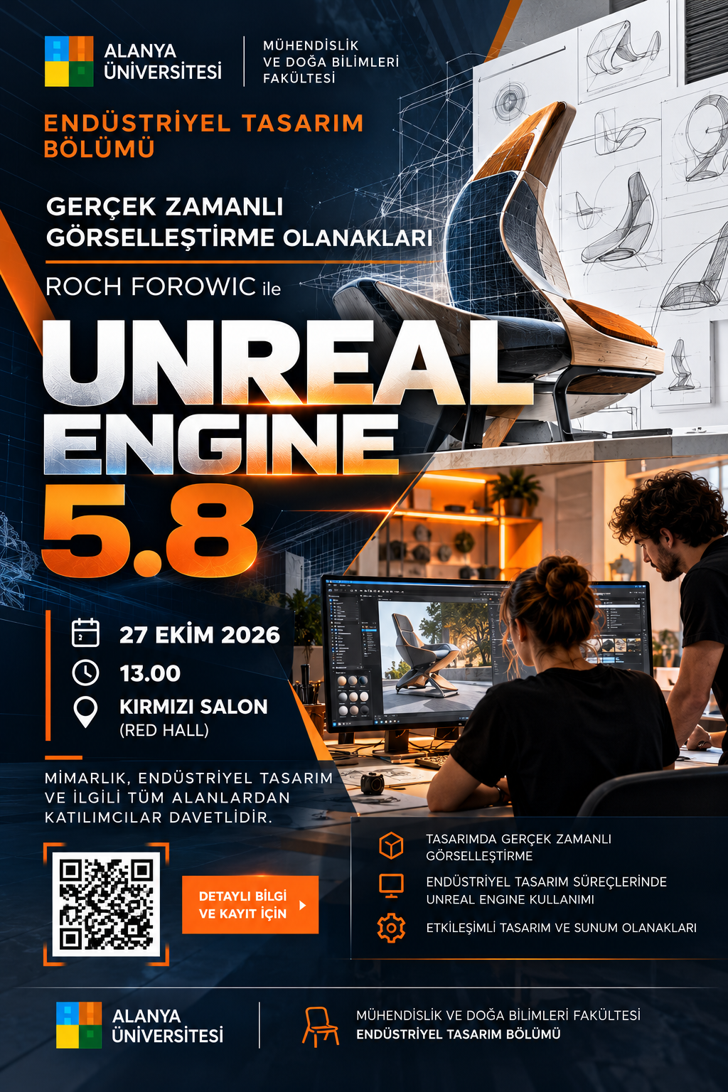
Alanya University, in collaboration with the University of Technology and Arts (UT/A), will host a presentation by Roch Forowic titled “Possibilities of Real-Time Visualization.” Scheduled...
11th Intercontinental Geoinformation Days (IGD 2026)
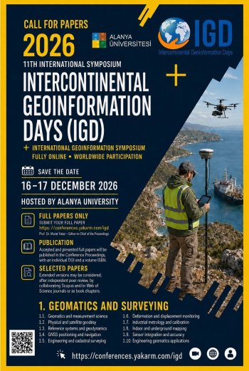
Alanya University to Host the 11th International Geoinformatics Days (IGD 2026)
16–17 December 2026 | Fully Online | Call for Full Papers
16–17 December 2026 | Fully Online | Call for Full Papers
Alanya University, through the Department of Industrial Design within the Faculty of Engineering and Natural Sciences, is pleased to announce the organization of the 11th International Geoinformatics Days (IGD 2026), which will take place on 16–17 December 2026 as a fully online international scientific symposium.
The symposium aims to bring together leading researchers, academics, engineers, designers, urban planners, graduate students, technology developers, industry professionals, and representatives of public and private institutions from around the world to exchange scientific knowledge, present innovative research, and strengthen international academic collaboration.
IGD 2026 provides an interdisciplinary scientific platform covering geoinformatics, geomatics engineering, Geographic Information Systems (GIS), remote sensing, Earth observation, photogrammetry, artificial intelligence, spatial planning, environmental management, digital twins, disaster resilience, and other emerging geospatial technologies.
Researchers and professionals are invited to submit original full papers addressing the symposium's scientific themes and related interdisciplinary research fields.
General Conference Information
| Information | Details |
| Official Conference Title | 11th International Geoinformatics Days |
| Conference Abbreviation | IGD 2026 |
| Conference Dates | 16–17 December 2026 |
| Host University | Alanya University, Türkiye |
| Participating Department | Department of Industrial Design |
| Faculty | Faculty of Engineering and Natural Sciences |
| Conference Format | Fully Online |
| Presentation Platform | Zoom |
| Official Language | English |
| Submission Type | Full Papers Only |
| Presentation Type | Live Online Oral Presentations |
| Publication | Official IGD 2026 Conference Proceedings |
| Certificates | Digital Presentation and Participation Certificates |
| Conference Chair | Prof. Dr. Murat YAKAR, Mersin University |
| Conference Co-Chair | Assoc. Prof. Dr. Hourakhsh AHMADNIA, Alanya University |
About International Geoinformatics Days
International Geoinformatics Days is an international scientific symposium dedicated to advancing research in geospatial information science, surveying, remote sensing, spatial analysis, Earth observation, and emerging geoinformation technologies.
The initiative originated in 2020 at the Department of Geomatics Engineering, Faculty of Engineering, Mersin University, under the title Intercontinental Geoinformation Days. Its previous editions have brought together researchers and professionals from numerous countries, contributing to the development of international scientific cooperation and the exchange of innovative geospatial research.
The first seven editions were organized between 2020 and 2023, with international meetings held in Türkiye, Iran, India, Azerbaijan, and Pakistan. The 10th edition was hosted by the University of Tehran in 2025.
Continuing this academic tradition, Alanya University will host the 11th edition in December 2026, strengthening interdisciplinary research cooperation and facilitating knowledge exchange among researchers, universities, public authorities, and industry representatives.
Conference Objectives
The main objectives of IGD 2026 are to:
- Promote international academic and scientific cooperation in geoinformatics, geomatics engineering, and related disciplines.
- Present innovative theories, methodologies, technologies, and applications involving geospatial information.
- Encourage collaboration between universities, research centers, government institutions, professional organizations, and industry.
- Advance interdisciplinary research integrating geospatial technologies with engineering, design, urban planning, environmental sciences, and artificial intelligence.
- Provide opportunities for young researchers, postgraduate students, and early-career academics to present original scientific studies.
- Support research contributing to sustainable development, smart cities, environmental management, disaster resilience, and climate adaptation.
- Promote emerging technologies such as GeoAI, digital twins, UAV mapping, LiDAR, remote sensing, and spatial data science.
- Discuss ethical, legal, technical, and institutional challenges associated with geospatial information and its practical applications.
Scientific Themes and Conference Scope
IGD 2026 welcomes original theoretical, experimental, computational, applied, and interdisciplinary research across 12 principal scientific themes.
1. Geomatics and Surveying
Geomatics and measurement science; physical and satellite geodesy; reference systems and geodynamics; GNSS positioning and navigation; engineering and cadastral surveying; deformation and displacement monitoring; industrial metrology and calibration; indoor and underground mapping; sensor integration and accuracy; engineering geomatics applications.
2. Remote Sensing and Earth Observation
Optical and thermal remote sensing; RADAR, SAR and InSAR; satellite and airborne observation; remote-sensing sensors and calibration; radiometric and atmospheric correction; image classification and change detection; data fusion and time-series analysis; spectral and physical modelling; field and laboratory validation; Earth-observation applications.
3. GIS and Spatial Analytics
GIS theory and data models; spatial and temporal analysis; spatial databases and cloud GIS; spatial data infrastructures; desktop, mobile and Web GIS; spatial decision-support systems; network and accessibility analysis; spatial statistics and geostatistics; cartography and geovisualization; open and collaborative mapping.
4. Photogrammetry, UAVs and LiDAR
Aerial and terrestrial photogrammetry; close-range photogrammetry; UAV design and operation; UAV sensors and navigation; UAV mission planning and safety; airborne and terrestrial LiDAR; mobile and UAV LiDAR; point-cloud registration and filtering; point-cloud classification; 3D modelling and reconstruction.
5. GeoAI and Spatial Data Science
Geospatial artificial intelligence; spatial machine learning; deep learning and foundation models; spatial data mining; geospatial computer vision; explainable and responsible GeoAI; generative AI and synthetic data; knowledge graphs and ontologies; real-time and Edge GeoAI; applied GeoAI solutions.
6. Land Administration and Management
Land policy and governance; land tenure and property rights; cadastre and cadastral renewal; Land Administration Domain Model; land-use planning and control; land consolidation and protection; land readjustment and regeneration; property valuation and markets; land information systems; integrated resource management.
7. Environmental Geoinformatics
Environmental GIS and assessment; climate monitoring and modelling; land-cover and landscape change; forestry and vegetation monitoring; precision agriculture and food security; water and groundwater monitoring; soil degradation and desertification; biodiversity and ecosystem assessment; pollution and contamination monitoring; natural-resource management.
8. Disaster Risk and Resilience
Disaster-risk assessment; earthquake and seismic hazards; flood and drought modelling; landslide-risk assessment; wildfire detection and mapping; coastal and tsunami hazards; vulnerability and resilience assessment; early-warning systems; emergency and evacuation planning; post-disaster damage assessment.
9. Transportation and Navigation
Transportation GIS; intelligent transportation systems; traffic monitoring and prediction; routing and network optimization; indoor and outdoor navigation; location-based services; autonomous and connected vehicles; maritime and aviation navigation; public-transport accessibility; sustainable mobility and logistics.
10. Earth and Engineering Geosciences
Geology and mineralogy; geomorphology and surface processes; geophysics and seismology; hydrology and hydrogeology; soil and subsurface studies; mineral and energy exploration; engineering geology; mining geoinformatics; infrastructure monitoring; geological-hazard assessment.
11. Hydrospatial and Marine Mapping
Hydrographic surveying and bathymetry; sonar and marine sensing; marine positioning and navigation; coastal and shoreline mapping; seabed and underwater modelling; marine environmental monitoring; nautical cartography; marine spatial data; offshore and port surveying; autonomous marine mapping.
12. Digital Twins and Geospatial Governance
Geospatial digital twins; 3D and 4D modelling; BIM and GIS integration; IoT and sensor networks; infrastructure digital twins; environmental digital twins; spatial simulation and prediction; standards and interoperability; data governance and ethics; extended reality and education.
Interdisciplinary studies addressing emerging scientific and technological developments related to these fields are also welcome.
Who Can Participate?
The symposium welcomes participation from university faculty members, researchers, undergraduate and postgraduate students, engineers, architects, industrial designers, urban and regional planners, GIS and remote-sensing specialists, environmental professionals, government representatives, municipal authorities, disaster-management organizations, technology companies, and international institutions.
Professionals working in agriculture, forestry, water resources, transportation, infrastructure, cultural heritage, spatial planning, environmental management, and related sectors are particularly encouraged to participate.
Important Dates
IGD 2026 welcomes original theoretical, experimental, computational, applied, and interdisciplinary research across 12 principal scientific themes.
1. Geomatics and Surveying
Geomatics and measurement science; physical and satellite geodesy; reference systems and geodynamics; GNSS positioning and navigation; engineering and cadastral surveying; deformation and displacement monitoring; industrial metrology and calibration; indoor and underground mapping; sensor integration and accuracy; engineering geomatics applications.
2. Remote Sensing and Earth Observation
Optical and thermal remote sensing; RADAR, SAR and InSAR; satellite and airborne observation; remote-sensing sensors and calibration; radiometric and atmospheric correction; image classification and change detection; data fusion and time-series analysis; spectral and physical modelling; field and laboratory validation; Earth-observation applications.
3. GIS and Spatial Analytics
GIS theory and data models; spatial and temporal analysis; spatial databases and cloud GIS; spatial data infrastructures; desktop, mobile and Web GIS; spatial decision-support systems; network and accessibility analysis; spatial statistics and geostatistics; cartography and geovisualization; open and collaborative mapping.
4. Photogrammetry, UAVs and LiDAR
Aerial and terrestrial photogrammetry; close-range photogrammetry; UAV design and operation; UAV sensors and navigation; UAV mission planning and safety; airborne and terrestrial LiDAR; mobile and UAV LiDAR; point-cloud registration and filtering; point-cloud classification; 3D modelling and reconstruction.
5. GeoAI and Spatial Data Science
Geospatial artificial intelligence; spatial machine learning; deep learning and foundation models; spatial data mining; geospatial computer vision; explainable and responsible GeoAI; generative AI and synthetic data; knowledge graphs and ontologies; real-time and Edge GeoAI; applied GeoAI solutions.
6. Land Administration and Management
Land policy and governance; land tenure and property rights; cadastre and cadastral renewal; Land Administration Domain Model; land-use planning and control; land consolidation and protection; land readjustment and regeneration; property valuation and markets; land information systems; integrated resource management.
7. Environmental Geoinformatics
Environmental GIS and assessment; climate monitoring and modelling; land-cover and landscape change; forestry and vegetation monitoring; precision agriculture and food security; water and groundwater monitoring; soil degradation and desertification; biodiversity and ecosystem assessment; pollution and contamination monitoring; natural-resource management.
8. Disaster Risk and Resilience
Disaster-risk assessment; earthquake and seismic hazards; flood and drought modelling; landslide-risk assessment; wildfire detection and mapping; coastal and tsunami hazards; vulnerability and resilience assessment; early-warning systems; emergency and evacuation planning; post-disaster damage assessment.
9. Transportation and Navigation
Transportation GIS; intelligent transportation systems; traffic monitoring and prediction; routing and network optimization; indoor and outdoor navigation; location-based services; autonomous and connected vehicles; maritime and aviation navigation; public-transport accessibility; sustainable mobility and logistics.
10. Earth and Engineering Geosciences
Geology and mineralogy; geomorphology and surface processes; geophysics and seismology; hydrology and hydrogeology; soil and subsurface studies; mineral and energy exploration; engineering geology; mining geoinformatics; infrastructure monitoring; geological-hazard assessment.
11. Hydrospatial and Marine Mapping
Hydrographic surveying and bathymetry; sonar and marine sensing; marine positioning and navigation; coastal and shoreline mapping; seabed and underwater modelling; marine environmental monitoring; nautical cartography; marine spatial data; offshore and port surveying; autonomous marine mapping.
12. Digital Twins and Geospatial Governance
Geospatial digital twins; 3D and 4D modelling; BIM and GIS integration; IoT and sensor networks; infrastructure digital twins; environmental digital twins; spatial simulation and prediction; standards and interoperability; data governance and ethics; extended reality and education.
Interdisciplinary studies addressing emerging scientific and technological developments related to these fields are also welcome.
Who Can Participate?
The symposium welcomes participation from university faculty members, researchers, undergraduate and postgraduate students, engineers, architects, industrial designers, urban and regional planners, GIS and remote-sensing specialists, environmental professionals, government representatives, municipal authorities, disaster-management organizations, technology companies, and international institutions.
Professionals working in agriculture, forestry, water resources, transportation, infrastructure, cultural heritage, spatial planning, environmental management, and related sectors are particularly encouraged to participate.
Important Dates
| Activity | Date |
| Full Paper Submission Deadline | 16 October 2026 |
| Special Early Registration Deadline | 16 October 2026, subject to eligibility |
| Conference Dates | 16–17 December 2026 |
| Final Conference Program | Approximately one week before the conference |
| Final Official Acceptance Letters | Approximately one week after the conference |
| Presentation and Participation Certificates | Approximately one week after the conference |
| Announcement of Selected Papers for Additional Publication Opportunities | Approximately two weeks after the conference |
| Publication of Conference Proceedings | Approximately one month after the conference |
The official website should be consulted for any changes to the conference schedule and registration deadlines.
Full Paper Submission Guidelines
Researchers wishing to participate in IGD 2026 must submit complete, original, and previously unpublished full papers through the official online submission system.
All manuscripts must comply with the following requirements:
Full Paper Submission Guidelines
Researchers wishing to participate in IGD 2026 must submit complete, original, and previously unpublished full papers through the official online submission system.
All manuscripts must comply with the following requirements:
- Manuscripts must be prepared entirely in English.
- Only complete full papers are accepted; abstract-only submissions are not considered.
- All papers must follow the official IGD 2026 Full Paper Template.
- Manuscripts must be submitted in an editable Microsoft Word (.docx) format.
- Papers should include a clear title, abstract, introduction, research objectives, materials and methods, results, discussion, conclusions, and references.
- The abstract should be fewer than 200 words.
- All figures, tables, maps, photographs, and illustrations must be appropriately numbered, captioned, and referenced.
- Authors must follow the citation and reference-formatting instructions provided on the official conference website and in the manuscript template.
- Full names, institutional affiliations, countries, and ORCID identifiers must be accurate and consistent.
- Manuscripts must comply with scientific integrity, research ethics, copyright, and originality requirements.
- Authors should include applicable funding, conflicts-of-interest, data-availability, ethical-approval, and author-contribution statements.
- Manuscripts must not contain plagiarism, fabricated results, duplicate publication, or other serious academic misconduct.
- At least one author of each accepted paper must complete the required registration and deliver the oral presentation.
All submissions must be made through the official online system. Manuscripts submitted by email will not be processed.
Scientific Review and Acceptance
All submitted manuscripts will undergo scientific evaluation by reviewers with relevant academic expertise.
The review process will consider the scientific originality of the research, relevance to the conference themes, clarity of the research objectives, methodological appropriateness, reliability of findings, quality of analysis and discussion, academic writing, and compliance with the official formatting and publication requirements.
Following evaluation, manuscripts may be accepted, accepted subject to minor revisions, returned for further revision, or rejected.
Authors may be requested to revise their manuscripts in accordance with reviewers' recommendations.
Final acceptance is subject to satisfactory completion of the required revisions, registration procedures, and presentation obligations.
Publication Opportunities
Official Conference Proceedings
All accepted and presented full papers will be published electronically in the official IGD 2026 Conference Proceedings.
The proceedings are intended to provide an accessible academic record of the research presented at the symposium, including author information, bibliographic details, scientific contributions, and an ISBN-registered proceedings volume.
International Academic Book Chapters
Selected high-quality papers may be invited for further development into chapters for internationally published academic books.
Authors invited to contribute book chapters will be required to prepare extended and revised versions of their original conference papers, in accordance with the relevant publisher's requirements.
International Journal Publication Opportunities
Outstanding papers may also be considered for publication in collaborating academic journals following substantial revision, editorial evaluation, and independent peer review.
The conference website identifies potential journal opportunities involving publications indexed in Scopus and/or Web of Science, including Geomatik, Turkish Journal of Engineering, and the International Journal of Engineering and Geosciences, alongside other related publication venues.
Selection for further publication is not automatic. Invitations do not guarantee acceptance, and manuscripts must satisfy the independent editorial policies, scientific standards, and peer-review requirements of the relevant journals or publishers.
Online Presentation Arrangements
IGD 2026 will take place entirely online via Zoom, allowing researchers from different countries to participate without the need for international travel.
Accepted papers will be presented in thematic scientific sessions according to their research subject and disciplinary relevance.
According to the presentation guidelines, each oral presentation is allocated 7 minutes, followed by 3 minutes for questions and discussion.
Presenters are expected to prepare professional PowerPoint presentations using the official conference presentation requirements. Presentations should contain no more than 15 slides and must clearly communicate the study objectives, methodology, principal findings, discussion, and conclusions.
Presentations must be delivered live in English. Prerecorded presentations are not accepted under the published guidelines.
Presenters should join their assigned online sessions in advance, check their microphone and internet connection, and follow the instructions provided by the session chairs and technical organizers.
The final conference program, session allocations, and online access links will be communicated to registered participants before the symposium.
Certificates and Participation Benefits
Registered participants and presenting authors will have access to the conference's international scientific sessions and academic discussions.
Following successful participation, eligible attendees and presenting authors will receive digital certificates according to their registration and participation status.
The conference offers opportunities to present original research internationally, receive academic feedback, develop scientific collaborations, engage with researchers from other institutions, and disseminate eligible research findings through the official proceedings.
Conference Leadership and Academic Organization
Host Institution: Alanya University, Alanya, Antalya, Türkiye
Participating Academic Unit: Department of Industrial Design, Faculty of Engineering and Natural Sciences
Conference Chair: Prof. Dr. Murat YAKAR, Mersin University, Türkiye
Conference Co-Chair: Assoc. Prof. Dr. Hourakhsh AHMADNIA, Alanya University, Türkiye
The symposium is supported by an international scientific and organizing committee consisting of academics and researchers representing universities and research institutions from Türkiye and numerous other countries.
The international committee contributes to the scientific coordination, academic development, review process, and dissemination of the symposium's research activities.
Invitation to Researchers
Alanya University cordially invites researchers, academics, graduate students, engineers, designers, planners, and industry professionals worldwide to contribute to the 11th International Geoinformatics Days (IGD 2026).
The conference seeks to strengthen international scientific collaboration, encourage interdisciplinary innovation, and advance research addressing contemporary technological, environmental, engineering, and spatial challenges.
Researchers working in geoinformatics and related disciplines are encouraged to submit original full papers and participate in the symposium's international academic discussions.
For more information about the conference, important dates, registration requirements, publication opportunities, author guidelines, and full-paper submission, please visit the official conference website:
Scientific Review and Acceptance
All submitted manuscripts will undergo scientific evaluation by reviewers with relevant academic expertise.
The review process will consider the scientific originality of the research, relevance to the conference themes, clarity of the research objectives, methodological appropriateness, reliability of findings, quality of analysis and discussion, academic writing, and compliance with the official formatting and publication requirements.
Following evaluation, manuscripts may be accepted, accepted subject to minor revisions, returned for further revision, or rejected.
Authors may be requested to revise their manuscripts in accordance with reviewers' recommendations.
Final acceptance is subject to satisfactory completion of the required revisions, registration procedures, and presentation obligations.
Publication Opportunities
Official Conference Proceedings
All accepted and presented full papers will be published electronically in the official IGD 2026 Conference Proceedings.
The proceedings are intended to provide an accessible academic record of the research presented at the symposium, including author information, bibliographic details, scientific contributions, and an ISBN-registered proceedings volume.
International Academic Book Chapters
Selected high-quality papers may be invited for further development into chapters for internationally published academic books.
Authors invited to contribute book chapters will be required to prepare extended and revised versions of their original conference papers, in accordance with the relevant publisher's requirements.
International Journal Publication Opportunities
Outstanding papers may also be considered for publication in collaborating academic journals following substantial revision, editorial evaluation, and independent peer review.
The conference website identifies potential journal opportunities involving publications indexed in Scopus and/or Web of Science, including Geomatik, Turkish Journal of Engineering, and the International Journal of Engineering and Geosciences, alongside other related publication venues.
Selection for further publication is not automatic. Invitations do not guarantee acceptance, and manuscripts must satisfy the independent editorial policies, scientific standards, and peer-review requirements of the relevant journals or publishers.
Online Presentation Arrangements
IGD 2026 will take place entirely online via Zoom, allowing researchers from different countries to participate without the need for international travel.
Accepted papers will be presented in thematic scientific sessions according to their research subject and disciplinary relevance.
According to the presentation guidelines, each oral presentation is allocated 7 minutes, followed by 3 minutes for questions and discussion.
Presenters are expected to prepare professional PowerPoint presentations using the official conference presentation requirements. Presentations should contain no more than 15 slides and must clearly communicate the study objectives, methodology, principal findings, discussion, and conclusions.
Presentations must be delivered live in English. Prerecorded presentations are not accepted under the published guidelines.
Presenters should join their assigned online sessions in advance, check their microphone and internet connection, and follow the instructions provided by the session chairs and technical organizers.
The final conference program, session allocations, and online access links will be communicated to registered participants before the symposium.
Certificates and Participation Benefits
Registered participants and presenting authors will have access to the conference's international scientific sessions and academic discussions.
Following successful participation, eligible attendees and presenting authors will receive digital certificates according to their registration and participation status.
The conference offers opportunities to present original research internationally, receive academic feedback, develop scientific collaborations, engage with researchers from other institutions, and disseminate eligible research findings through the official proceedings.
Conference Leadership and Academic Organization
Host Institution: Alanya University, Alanya, Antalya, Türkiye
Participating Academic Unit: Department of Industrial Design, Faculty of Engineering and Natural Sciences
Conference Chair: Prof. Dr. Murat YAKAR, Mersin University, Türkiye
Conference Co-Chair: Assoc. Prof. Dr. Hourakhsh AHMADNIA, Alanya University, Türkiye
The symposium is supported by an international scientific and organizing committee consisting of academics and researchers representing universities and research institutions from Türkiye and numerous other countries.
The international committee contributes to the scientific coordination, academic development, review process, and dissemination of the symposium's research activities.
Invitation to Researchers
Alanya University cordially invites researchers, academics, graduate students, engineers, designers, planners, and industry professionals worldwide to contribute to the 11th International Geoinformatics Days (IGD 2026).
The conference seeks to strengthen international scientific collaboration, encourage interdisciplinary innovation, and advance research addressing contemporary technological, environmental, engineering, and spatial challenges.
Researchers working in geoinformatics and related disciplines are encouraged to submit original full papers and participate in the symposium's international academic discussions.
For more information about the conference, important dates, registration requirements, publication opportunities, author guidelines, and full-paper submission, please visit the official conference website:
The "International Seminar and Workshop on Accessibility in Architecture and Urban Design" will be organized by the Alanya University Department of Industrial Design on October 6, 2026, with...
The 11th International Geoinformatics Days (IGD 2026), organized with the contributions of the Department of Industrial Design, Faculty of Engineering and Natural Sciences at Alanya University, will b...
The 10th International Symposium on Advanced Engineering Days (AED10), organized by the Department of Industrial Design at Alanya University, will be held online on December 16–17, 2026.
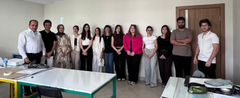
An orientation meeting was held for our 1st-year students who have newly joined our department.
There are no event available.
See All